A walk from Ravenglass to Penrith - July 1991


Walks with a Camera © Geoff’s Pages 2011
The Cumberland way is described in an excellent little "Wainwright-style"
paperback by Paul Hannon, pub. Hillside Publications. It is a six day walk across
the old county of Cumberland, from Ravenglass on the coast to Appleby (in the
old county of Westmorland). Two further walks - the Westmorland Way, from
Appleby to Arnside, and the Furness Way, from Arnside to Ravenglass, complete
this (very roughly) triangular walk in and around the English Lake District.
Our itinerary was not quite complete, strictly speaking. We
left the car at Penrith and, on our first day, travelled by
public transport to Ravenglass. The sixth "official" day
didn't look too exciting, and returning to Penrith on the fifth
day would nicely complete our route. And (perhaps most
important) our "pass-outs" would expire before we got to
Appleby....


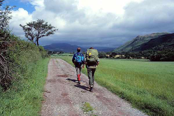
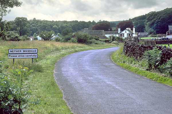
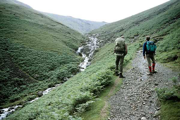
Day 1: Ravenglass - Nether Wasdale
We lunched well at the "Ratty" station buffet, before beginning
our almost 10 mile walk across pleasant country, with the view to
the hills drawing us onwards. An interesting, if none-too-direct
route took us via quiet farm tracks to the isolated Irton church,
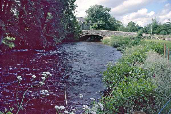
then, across fields to Santon Bridge, where
the dark waters of the River Irt flow swiftly
on their way from Wastwater to the sea.
From Santon Bridge, a riverside path
followed by more field walking leads
eventually to the quiet village of Nether
Wasdale, also known as Strands, where the
two excellent inns provided our food, drink
and overnight stay.

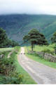
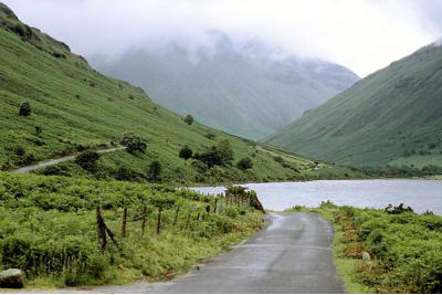
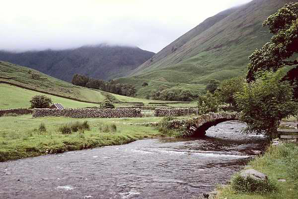
Day 2: Nether Wasdale - Buttermere

Day 4: Swinside - Dockray


Day 5: Dockray - Penrith

The path leaves Strands and crosses the Irt to head
for the outflow of Wastwater. Here the more
energetic walkers may follow the traverse along
the southern shore, at the foot of the famous
screes, but conscious of the day's 14 miles and two
mountain passes, we took the "official" route,
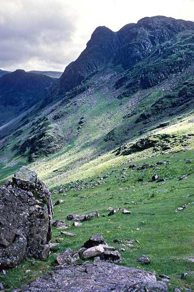
along the quiet road to Wasdale Head.
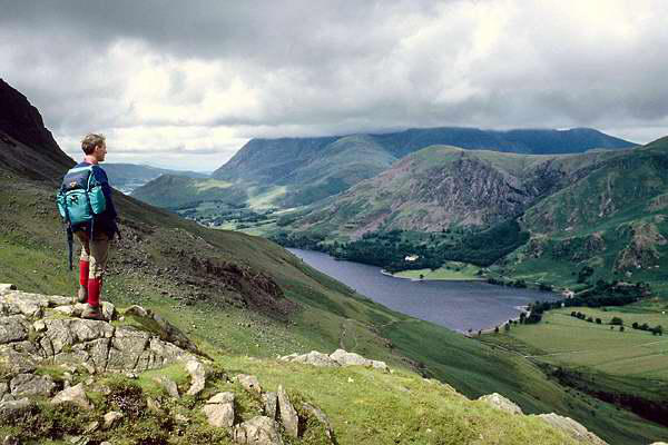
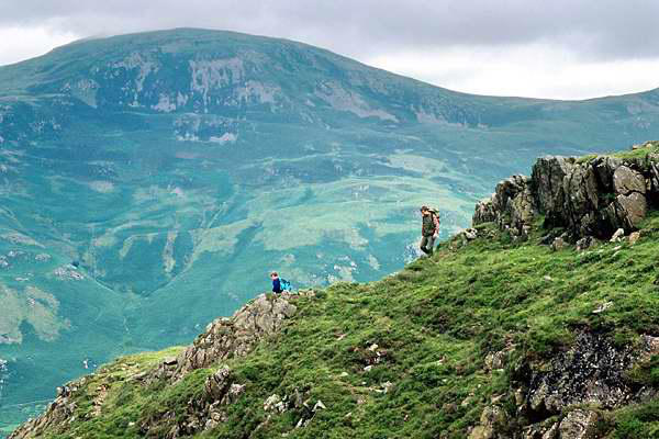
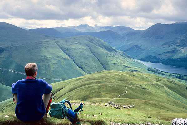
Here we took to the hills - firstly over Black Sail
pass to the lonely youth hostel Buttermere and
the mist-topped Grasmoor at the head of
Ennerdale, before climbing again over Scarth Gap
pass into the Buttermere valley. The day had
started with light rain, and
cloud on the tops, but now
it was improving, and we
had some fine views as we cleared Scarth
Gap - extending to Criffel, the Scottish
peak away across the unseen Solway Firth.
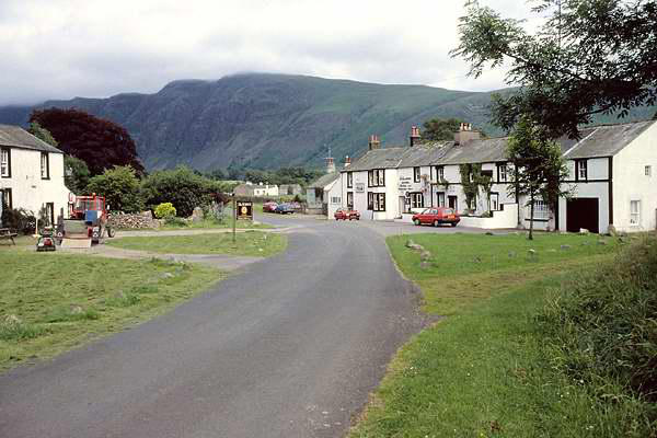
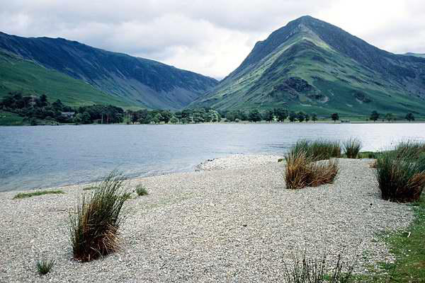
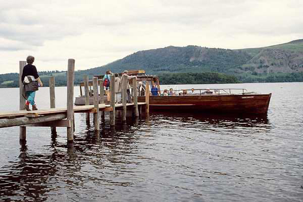
The path follows the western shore of the
lake to bring the walker into the village. On
this warm afternoon, we felt slightly
superior to the poor motorists struggling to
find a parking spot.
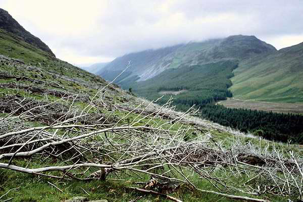

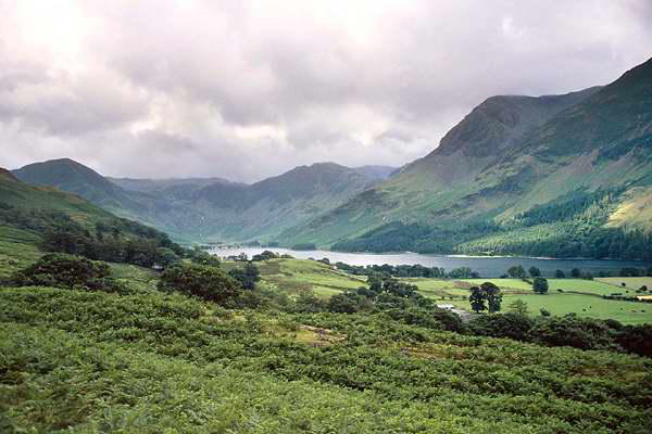
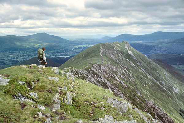
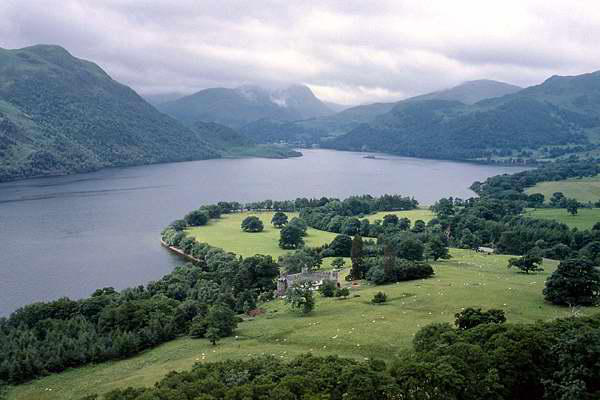
Day 3: Buttermere - Swinside
This should have been "Buttermere - Keswick" - but we had
planned our walk for the same week as the annual Methodist
Convention. In booking our overnight accommodation, we had left
Keswick to the last, but it turned out to be the most difficult. In
the end we settled for the Swinside Inn, between the hamlet of
Stair and the Hawse End jetty on Derwentwater. It would shorten
our days walk significantly - but would extend the following day
by an equal amount.
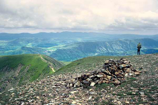
Given a pretty short route, we opted for the high level
alternative - instead of the gentle ascent via Sail Beck, we would
traverse the Whiteless Pike - Causey Pike ridge. I think it was on
this stage of the walk that I realised that a couple of heavy Nikon
bodies and two or three weighty lenses didn't make the ideal kit
for this type of trip....
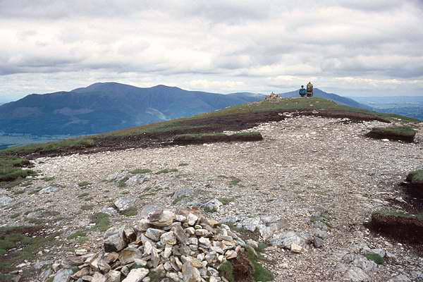
We left the inn and followed what should have been the previous
day's route into Keswick, before heading on via Castle Head to
the stone circle at Castlerigg. Continuing via St John's in the Vale,
the Cumberland Way then follows an old coach road around the
northern foothills of the Helvellyn range, reaching a summit level
of around 1450' before dropping gently down to the tiny village of
Dockray, where we would spend our last night. It rained all day -
sorry, no pictures (I wasn't planning on putting this page together
in 1991). The camera stayed in the rucksack. There wasn't much
to do in Dockray in the rain either - though at least there was a
pub...
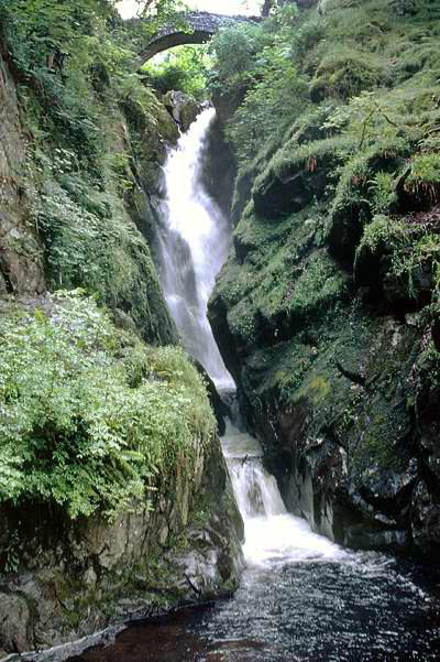
Dockray straddles Aira Beck - and a mile or so
downstream, on route, is the shapely Aira Force, a
regular destination on the Lakes tour.
On leaving the waterfall, a pleasant path traverses
Gowbarrow Fell, with magnificent views of
Ullswater at first. Later, the
path takes to the open
country, and by a slightly tortuous route
across the fields, we ended up at Stainton,
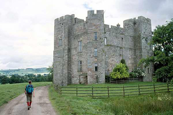
a village about 2 miles from Penrith. Here
we would part company with the
Cumberland Way, and in celebration of
the fact, we entered the pub, only to
find it had just closed! The landlord
seemed prepared to serve us, so we took
our drinks and sat
outside, to reflect on a
very enjoyable five days traversing this beautiful
part of the country.
And that was it. Just the couple of miles along
the road to Penrith, then back to the car and
home.
Paul Hannon's "Cumberland Way" is out of print - used copies are sometimes available on Abebooks or Amazon