A trip to the "misty isle" - July 1994


Walks with a Camera © Geoff’s Pages 2011
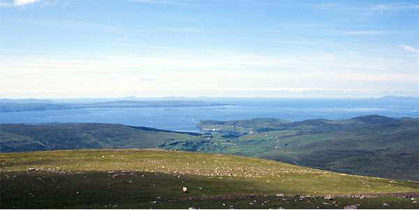
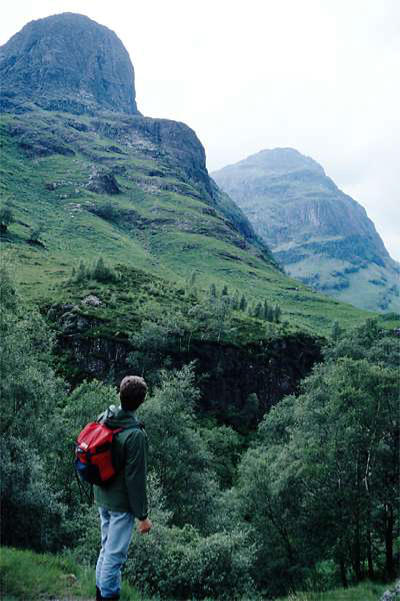
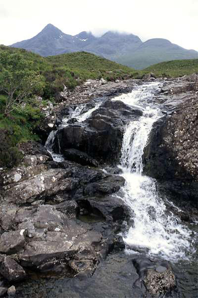
Departing early on the first day, we stopped in Glencoe, for lunch
and a short walk.

Day 1: Journey north


Day 2: South Harris
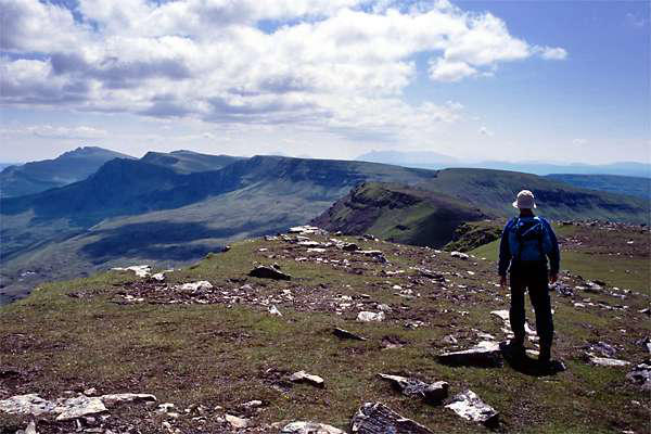
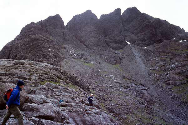
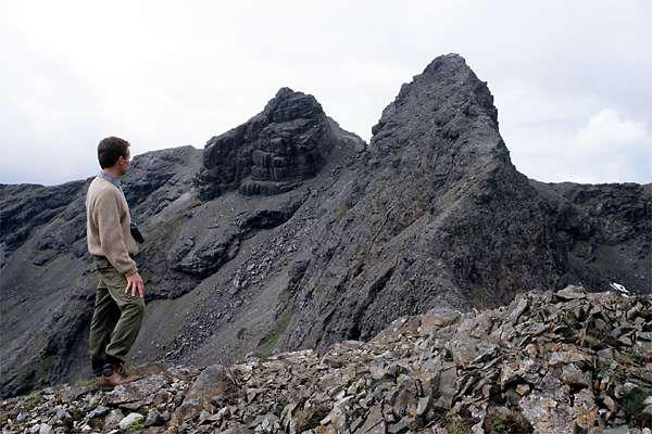
....is one of the Cuillins - viewed from Sligachan,
it's the one in the middle, with the "tooth" sticking
out of its right side.
We hadn't set out that day to climb it. The weather
hadn't been very great, and we had thought about
a low-level exploration, perhaps a walk up Glen
Sligachan, but it was looking better as we
approached, so we took to the hills.
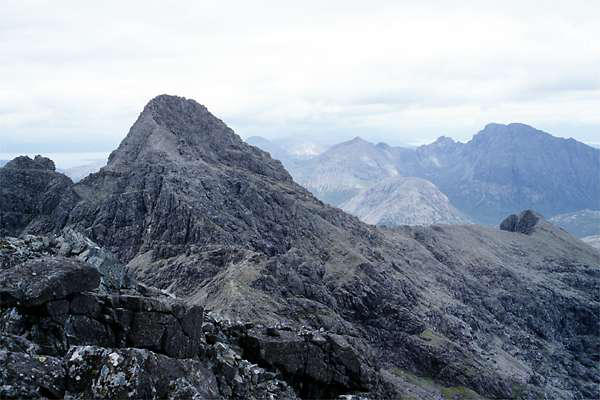
We followed the route above Coire a'Bhasteir, passing beneath the
pinnacles of Sgurr nan Gillean, where small patches of snow
remained in the deeper hollows. Reaching the main ridge between
Sgurr nan Gillean and Am Basteir, we realised that the route to the
former was not for us, but Am Basteir looked possible...
...and so it proved. Despite its stark appearance from the col, a
distinct route follows the ridge upwards, with just one tricky spot,
leading to a fine summit peak.


Day 3: Am Basteir

Day 5: Just lazing
Well, we'd earned it. And unusually for Skye, it was
really too hot for anything energetic.
So we decided on a Talisker day - firstly, a trip to
the distillery where that most distinctive whisky is
produced, then a short walk to the sea at Talisker
Bay. Oddly enough, the distillery is at Carbost, on
the opposite side of the peninsular.
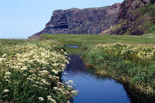
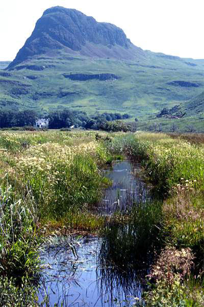
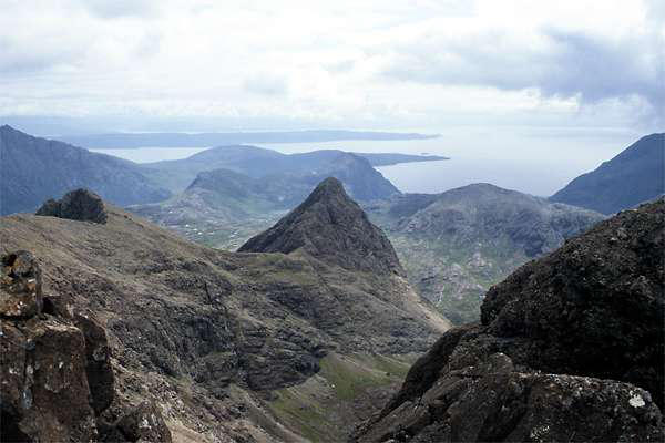
The road down Glen Oraid ends about a
mile from the shore. Leaving the car, a
private road takes one past Talisker House,
from where a path follows the stream
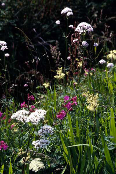
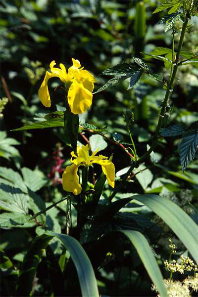
towards the sea. An amazing variety of
plant life flourishes beside the stream,
while, looking back, the
superb pinnacle of Preshal
Mor stands guardian over
the glen.
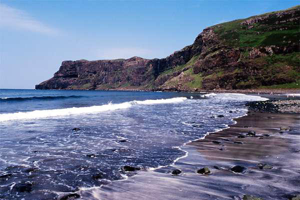
The distance from the road
means the bay is pretty quiet, though there were a
few sunbathers (not a common
sight on Skye). At low tide, the fine
rocky sea stack at Talisker Point is accessible with
care - but on this occasion, it wasn't, so we didn't.
And that was it for our '94 trip. The following day,
hotter still, we headed for home, after an
excellent few days with some real variety.
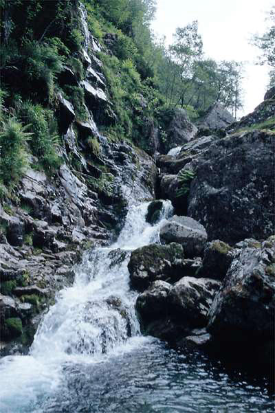
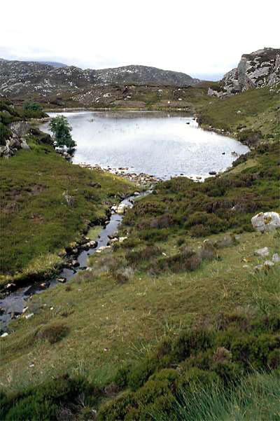
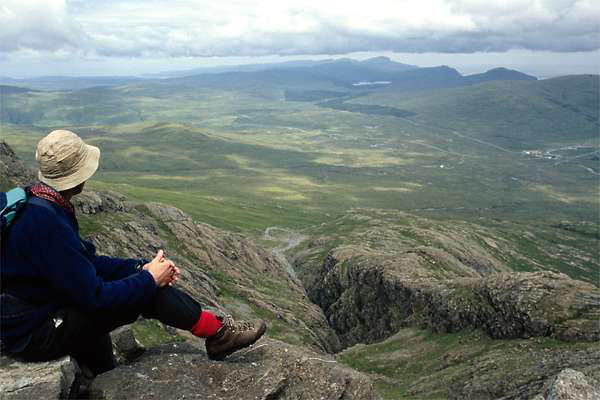
We parked near the top of the road from Ballachulish, and set off
down the path to the "Meeting of the Three Waters", there taking
the path into the Allt Coire Gabhaill (also known as the "Hidden
Glen" or "Lost Valley" or something along those lines), an
attractive hanging valley surrounded by the Glencoe peaks.
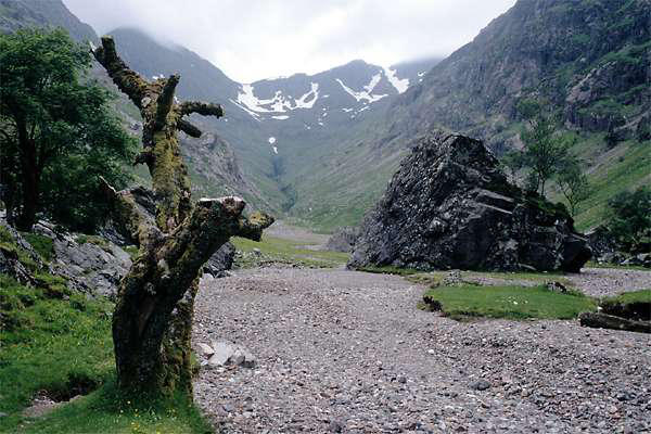
Ascending to one of these would have been a fine expedition, but
would have meant arrival at our destination in the wee small
hours - so we ate our lunch and returned to the car, refreshed for
the remainder of the journey. "We ought to come here again -
spend a few days here next time"...
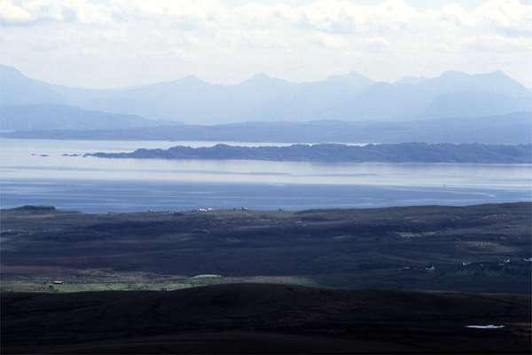
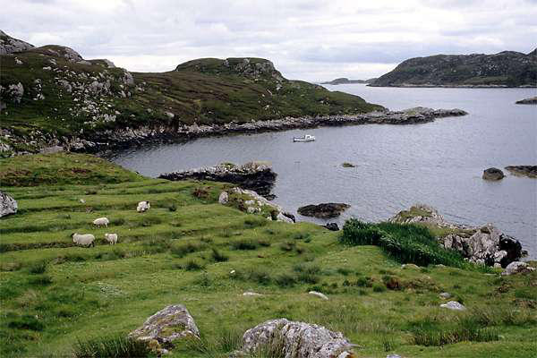
The ferry from Uig sails to both Tarbert, Harris and Lochmaddy,
North Uist. A trip across the Minch and an exploration of one of
the "outer isles" seemed an attractive proposition, and given the
complexities of the timetable, this would be the only day of trip
when such an expedition was feasible.
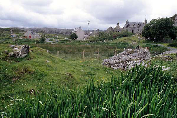
A couple of coach trips are possible from Tarbert. Designed to
cater for day trippers from Skye, one travels to Stornoway, the
other to the sights of South Harris. The latter also serves as a
service bus - we used it to ride to Plocrapool, a few miles to the
south west.
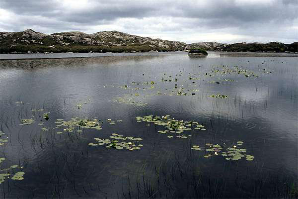
Our walking route took us across the moorland to Scadabay. The
landscape in this part of Harris is a fascinating
tangle of loch and lochan, moor and crag. There
seems to be more water than land, and many of
the dark peaty pools have water lilies growing on
them in abundance. Here and there the peat was
still being dug for domestic purposes - we passed a
couple of cutters, aided in their task by a bottle of
that which Soctland is famed for. I've heard it said
that more heat is generated in the cutting of peat than in its
burning. If the calorific content of the whisky is taken into
account, I'm sure it must be true. And I've never seen so many
empty whisky bottles as on our walk that day....
This was a walk whose highlights were in its early
stages - the last part being the long march back
along the road to Tarbert (well, we didn't want to
miss the ferry!)


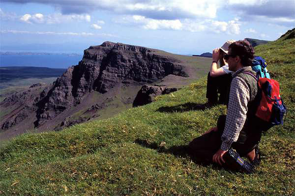
Day 4: The Trotternish Ridge
This walk needs the use of a second car -
driving firstly to the end of the walk, below
the Storr, we were then driven to the
bealach on the Uig - Staffin road. Most
people stopping here walk north to the
Quiraing - on this occasion, we headed south.
Our walk started at 640', and most of the peaks on the ridge are
around 2000' - hardly any climbing, it might seem (The Storr is a
bit higher, at 2358', but we would not be climbing to its peak). In
the event, we did more climbing than I'd ever imagined. Go to
Gairloch on the mainland and look across to Skye - the ridge is
clearly a serpent!
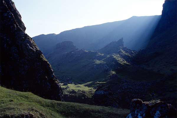
The nature of the Trotternish peninsular means that, on both sides
of the ridge, the sea is visible below. To the west lies Uig, and
views to Waternish and the outer isles, to the east Rona and
Raasay and the north-west highlands. And along the ridge - total
solitude. We didn't see another person from leaving the car, until
we rounded the shoulder of land beneath the Storr. There, some
way below us, two people had pitched a tent, and one sat outside
it, playing a penny whistle. Other than that, just the sheep and
the rabbits - and high above, a Golden Eagle.
The day was hot, and as we approached the Storr, our drinks were
getting low and warm. Then, beside the path, a line of springs,
with convenient tiny falls, ideal for refilling water bottles. A mist
of condensation formed instantly as the icy water filled the
bottles - and no liquid ever tasted so good.
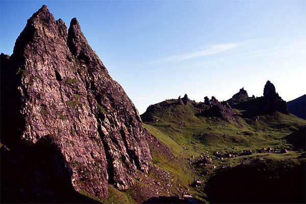
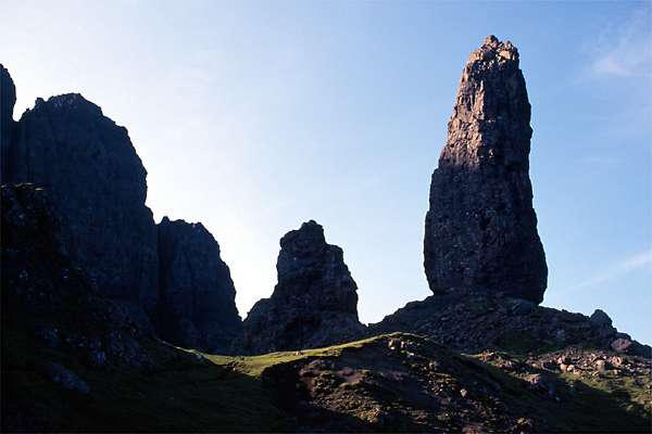
We were now on the last stage of the walk - dropping down to the
amazing Old Man of Storr and his companion pinnacles and crags,
then descending steeply to cross the moor and return to the car,
parked by the shore of Loch Leathan. What a great walk it had
been.